Motto

Anytime, any place there is a storm to chase, that is where you'll find the Hunters of Thunder.

May 21 – Hiawatha HP – Sky boobs, tornadoes and sirens in the dark.

After the highs of Greensburg the previous day and sleeping at Wichita KS overnight the chase took us to northeast Kansas, north of Topeka. Two really nice cells formed on this day, one southwest of Topeka, and a second southwest of Hiawatha. We chose to pursue the northern cell and were rewarded with another good days chasing, some awesome mammatus (AKA Skyboobs!) and a few tornadoes under an open structured HP type supercell. We started south of the cell, and raced north and intercepted it as it matured near Hiawatha.

The cell showed a powerful signature on radar as we approached and was warned for Tennis Ball hail (and not just warned, observed by some people who got a little too close). Thanks to some roadwork it took a race against the wrapping of the RFD (Rear Flank Downdraft) and the hail core of a second cell to the south to get on the right side of the storm.


The punch paid off, and we found ourselves in an excellent position, in time to see the storms first tornado under a nicely structured base.  


A quick reposition across the Missouri River and we got to see an impressively structured wall cloud, and the pursuit continued across the hills of northern Missouri. 


We were back on it for the second tornado north of St Joseph as the storm appeared to structure further. We continued to follow the cell east until dark, and observed another weak tornadoes before the storm dissipated. 


This wasn't the only drama though, as just because the sun goes down the storms don't stop. Tornado warned storms in a complex structure were coming rapidly from the west, and we were forced to drop south with the prospect of tennis ball hail from many of the storms. We came through Kansas city on the edge of another cell. 


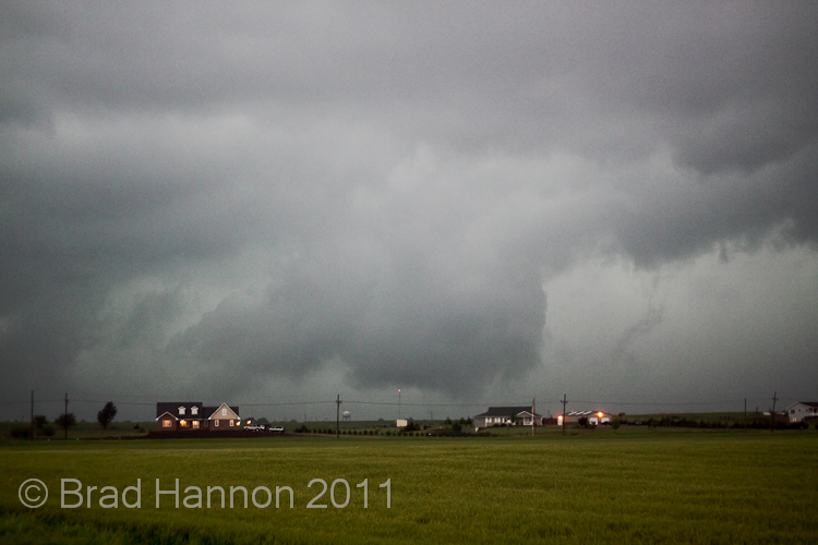
We were pumping fuel and contemplating our next move when overhead a haunting siren sounded, chilling us to the bone.  When you hear one of these on video you will understand how eery these things are at night...pretty scary if you don’t know what is out there. We decided the safest course was not to be in Kansas city with tornadoes bearing down and quickly skirted south, getting a view of the first incoming cell illuminated by lightning(which fortunately dissipated coming into Kansas city, a greater metro of around 2.1 million). We were observing radar at the time, and seeing three training monster supercells with tornadoes on the ground or potential to produce them was surreal, one of these cells produced an EF3 tornado which did significant damage to Reading, KS. We managed to stay out of trouble and ended up in Wichita for the night once more.

Crikey and Feathers

May 20 - Greensburg Gold

This is the sort of day that a photographer dreams about. Outstanding colours, gorgeous structure and slow moving supercells. Original target was between Pratt and Greensburg, and the storms had little risk of becoming tornadic with a weak low-level shear profile, but still provided the most photogenic day of the trip, and one of the best we've seen in the states. While we had a huge number of shots from this day, we have only chosen a sample of the top shots for brevity. Our chase target was rewarded with us being amongst the first on the nice supercell which formed SW of Greensburg.


The amazing thing was, it was only a taste of things to come. The second and third supercells were also photogenic (though they couldn't even make either of our top 4s), and as the hordes of chasers descended they were drawn away by the earlier cells moving northeast. As the cells moved into this environment they became more outflow dominant, and we dropped onto the southernmost cell (4th supercell and the storm of the day), which turned out to be the best of the lot.


The supercell's base was separated from the rear-flank downdraft and foward flank downdraft  such that you could drive between them, offering a unique view of many of the features of a supercell that you rarely get to see (without driving into a tornado or copping the really big hail).


It left us unconcerned that we were behind the storm, knowing that if somehow the storm managed to go tornadic we would see what was going on.


The photographic opportunities only improved as the sun got lower, and we were rewarded with a sunset that was beyond belief, and these two shots from 'feathers' show the closest thing to being there, we only wish you could have seen it.


A grand day for photography, and one that will be etched into our memories for many years to come.

Crikey and Feathers

May 19 - The Dorrance Dog

The chase day 5 started off in Enid, Oklahoma with solid conditions predicted for west central Kansas despite early morning convection. Our target was Pratt, with an adjustment depending on the movement of the triple point and warm front which were the optimal play for tornadic storms. A tornado watch soon followed as cells began to rapidly convect, and finally after watching convection bubble for some hours the storms formed as the triple point lifted north along with the warm front near Great Bend , Kansas where we had repositioned. The chase was on and the storms were moving relatively fast.


The storm we were on quickly went tornado warned, and shortly thereafter transitioned towards a HP mode and took photogenic expectations to a whole new low. In fact, pretty much our first good view of it was the best of the day.


After that it got, well messy. Typical of larger HPs in a relatively high low-level shear environments there were multiple areas of rotation, and keeping up with the active areas was a real trick. This particular area was producing funnels near Dorrance.


While moving east on I70 we ran into some incredible outflow along the southern flank of the storm, but eventually making it into the bear cage and this gave us a chance to see what the storm was up to. The rotating areas in the bear cage were quite impressive, but not the main focus.


As the storm moved east towards us we caught sight of an interesting feature to our north:


We quickly repositioned east and north as the rain and wind threatened to trap us in the HP, but the roads resisted our best attempts until we got bogged trying to park on the edge of a dirt road that had already been rained on (while getting the car off the highway). After some frantic pushing and skilled work from Feathers we managed to get ourselves out and away from the cage, but before our escaped we saw the below.


Tornadoes on this day were hard to make the final call on, but apparently the one above was a reality reported to the NWS, and we got  what appeared to be one in the first phase near Dorrance. This feature produced some interesting behaviour near Minneappolis.The storm was becoming increasingly ugly.


A further low contrast weak white tornado was recorded further east which we saw, but the storm had started to sprint off and was producing large hail  (golfballs we encountered as the RFD came round the white funnel) which stopped us keeping up.


All in all a successful chase day, just disappointing it took our equipment to its limits just to show the images above. Good to get our first tornadoes of the trip, we were hoping they would look better though.

Crikey and Feathers.